Need to convert your AutoCAD DWG files to a format compatible with Google Earth? Whether you're working on site plans, utility maps, or geospatial layouts, exporting your CAD data into KML or KMZ is essential for visualizing and sharing designs in a georeferenced environment. In this guide, we'll walk you through each step using our powerful Automapki Application, which works with AutoCAD, BricsCAD, and ZWCAD.
How to Export and Convert AutoCAD DWG to Google Earth KML: Step-by-Step Guide
Load Your DWG Drawing in AutoCAD:
Open your DWG drawing in AutoCAD. Ensure Automapki Application is installed and active. This tool enables seamless export of AutoCAD data into KML format for use with Google Earth.
Set Spatial Coordinate System:
For precise alignment with Google Earth, click on the Init Coord Sys ribbon button and assign the appropriate coordinate system to your DWG drawing.
Run AmExportMap Command to Export KML:
Use the AmExportMap command to select which entities in your drawing to export. Choose the output location and file name for your KML export.
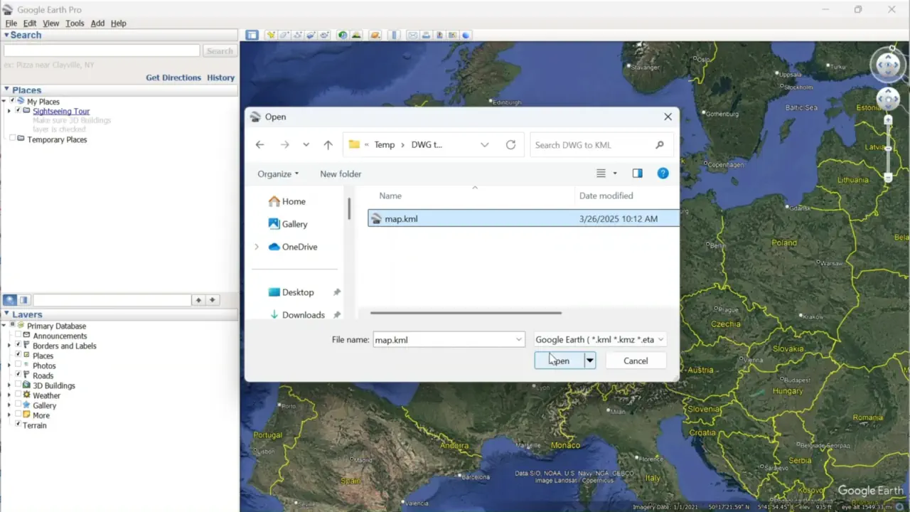
Open and Check KML in Google Earth:
Open Google Earth Pro and load the exported KML file. Use the File menu to import your file. Verify that drawing elements align accurately with the satellite imagery and adjust the visualization settings if needed.
FAQ: Can I Export DWG Files to KMZ Instead of KML?
Yes, absolutely! Our tool supports both KML and KMZ formats. While KML is an open XML-based format, KMZ is simply a compressed version of KML, bundling the KML file with any associated resources like images, icons, or textures.
To export a DWG drawing directly to a KMZ file:
- Run AmExportMap: Follow the same export process using the AmExportMap command.
- Set .kmz Extension: In the save dialog, change the file extension from .kml to .kmz.
- Auto KMZ Packaging: Automapki will automatically package your KML into a KMZ container for easier sharing.
KMZ files are especially useful when you want to email your maps or upload them to Google Earth without worrying about broken links or missing elements.
DWG to KML/KMZ Conversion: Conclusion
Converting your AutoCAD DWG drawing to KML or KMZ files is simple with our Automapki plugin. By setting a proper coordinate system and using the export map command, you can export georeferenced CAD data ready for Google Earth visualization. Whether you're using BricsCAD, ZWCAD, or AutoCAD, Automapki makes DWG-to-KML/KMZ conversion seamless.
Download the latest Automapki plug-in and start exporting your drawings to Google Earth with precision and ease. Also, explore our tutorials on how to convert DWG files to other geospatial formats.