Looking to convert your AutoCAD drawing into a KML or KMZ map file for use in Google Earth? This tutorial walks you through the exact steps using our powerful Automapki Application. Exporting CAD data into Google Earth has never been easier!
How to Export and Save KML Google Earth Map File from AutoCAD: Step-by-Step Tutorial
Download Automapki Application:
Start by downloading the free evaluation version of our Automapki Application for AutoCAD, BricsCAD, and ZWCAD.
Execute Map Export Command:

Open AutoCAD and type AmExportMap in the command window, or click the Export Map item in the application menu.
Customize Coordinate Reference System:

Select from 3000+ coordinate reference systems by searching for the appropriate EPSG code or the relevant country.
Select DWG Entities for Export:

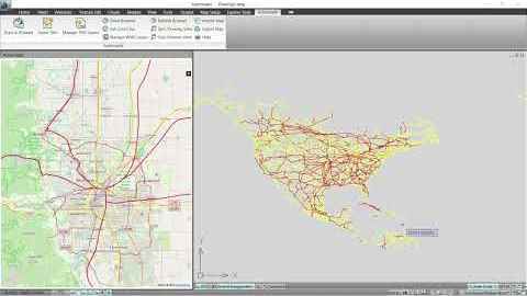
Choose the DWG drawing entities you want to export and convert into a KML file.
Export DWG Entities to KML Format:

After selecting your entities, press Save to export them as styled line strings and polygons in your KML map file.
Export to KMZ Format (Optional):

This tool also supports exporting to compressed KMZ format (Google Earth Placemark files), ideal for sharing and distribution.
FAQ: Can I Export a KML File Directly from AutoCAD Without Third-Party Tools?
No, AutoCAD does not natively support exporting KML or KMZ files directly. While it allows for basic geolocation and mapping features, it lacks built-in support for Google Earth formats such as KML or KMZ. To export AutoCAD drawings into these formats, you need to use a third-party plugin or application, which is designed specifically for this purpose.
Conclusion: Exporting DWG to KML or KMZ from AutoCAD Made Easy
With Automapki add-on, you can convert your DWG entities into fully styled KML/KMZ files with coordinate system control, entity selection, and visual customization, ensuring smooth compatibility with Google Earth. Visualize your CAD work in Google Earth with precision and ease. Start transforming your geospatial projects today!